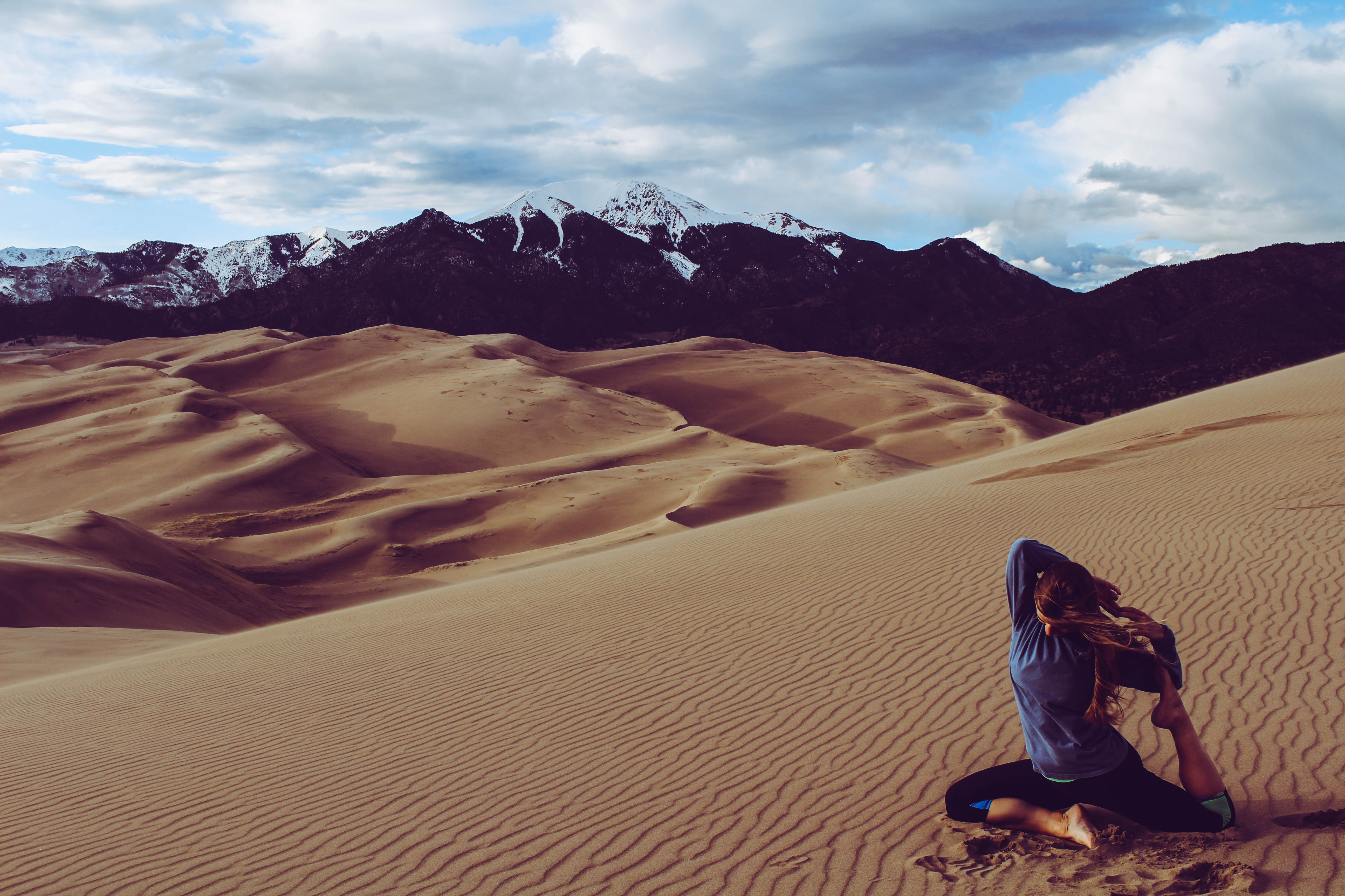
Colorado Road Trip Part II: Mesa Verde, Million Dollar Highway, and Black Canyon of the Gunnison
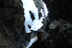
Zapata Falls
On the second morning of our road trip in Colorado, my cousin Sydney and I left the Great Sand Dunes campgrounds and headed to Zapata Falls. This waterfall hike is really close to the sand dunes. You can even see the dunes from the parking lot at the trailhead. To get to the trailhead, you must drive a few miles up a road filled with potholes. You arrive at the falls after about a half mile hike. It was freezing that morning so we didn’t stay long. The falls were frozen completely solid. We snapped a few pics and went on our way.
On our way out, we stopped in Alamosa at the cutest little coffee shop to get some breakfast.
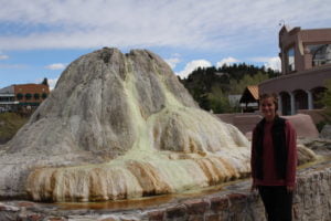
Pagosa Springs
Pagosa Springs is named for the sulfur springs beneath the town. These are the world’s deepest geothermal hot springs! There is a resort in town that has several pools fed from the springs that you can play in. We didn’t feel like spending the money, so we admired the large mineral formations and continued on.
Mesa Verde
Mesa Verde is a historical site in southwest Colorado that holds some of the best preserved Puebloan archaeological sites in the US. The Mesa Verdeans built their dwellings into the side of a cliff. It’s amazing to see what they were able to accomplish without modern technology, and how much of it still exists!
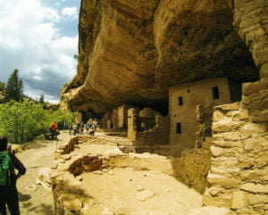
After a long drive from the park entrance to the dwellings, we were able to start our hike. There are several different locations with formations, but some require a tour that costs extra money, so we stuck to the free locations. We decided on the Spruce Tree House trail, as it is self guided and close to the museum. The paved loop is about a mile in length. Parts of it are pretty steep and we passed several elderly people who were struggling making their way down. I’d suggest using hiking poles![]() or a walking stick if you have trouble with steep declines. Once we arrived, we explored the dwellings and even caught part of a tour guide’s explanation of what certain “rooms” were used for.
or a walking stick if you have trouble with steep declines. Once we arrived, we explored the dwellings and even caught part of a tour guide’s explanation of what certain “rooms” were used for.
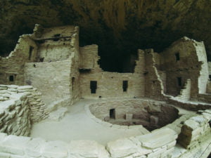
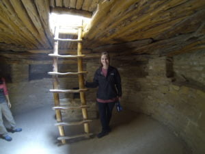
My favorite part was climbing down into the pit that was used for a fire place. The Puebloans had a somewhat complex ventilation system for their time. The pit had a shaft that pulled fresh air in, and would then release the heat through a hole in the floor in their homes. Pretty cool to see that, especially since I am an engineer!
Four Corners Monument
We were close to the border, so we decided to make the hour trip to the Four Corners Monument, the intersection of the states of Colorado, Utah, Arizona, and New Mexico. It’s touristy, but how often can you say you’ve stood in four states at once?? We missed the turn to get to the monument and ended up in New Mexico, 25 miles east of the Four Corners. Something that could’ve been easily avoided if we had been using a GPS instead of paper maps. Oh well! We backtracked and got to the entrance, realizing that it cost $20 just to get in! We figured we’d driven this far, so may as well pay it.
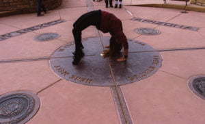
One limb in each state!
The monument itself is essentially just a large plaque on the ground that shows where the borders are. There were a few locals selling crafts, but that was pretty much it. I expected more since I paid $20.
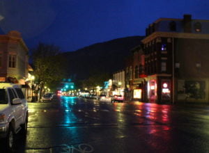
Durango
A storm was rolling in, so we drove to Durango, where we would be staying for the night in an Airbnb. We were craving protein, so we got huge burgers and brews at Carver Brewing downtown. A great way to end our day.
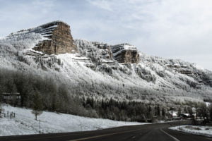
Million Dollar Highway
Our last major destination of the trip was the Black Canyon of the Gunnison. We took the scenic route by means of the Million Dollar Highway. The Million Dollar Highway is the stretch on Route 550 between Silverton and Ouray. Although this stretch is only about 25 miles, the route from Durango is gorgeous the entire way. The road takes you up through the mountains, so it was snowy, even in May. We even drove through a snowstorm at the top.
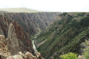
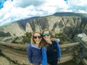
Black Canyon of the Gunnison National Park
This canyon was carved by the Gunnison River and is very narrow compared to other canyons I’ve visited. The drive to the canyon from the entrance takes a while and is scary since you’re driving on the edge of a very steep cliff. We hiked a short trail and then drove to a few other viewpoints.
We got back to Denver late that night after a long day of driving. I enjoyed a couple more days in Denver before heading home.
Sights seen on our trip:
Colorado Road Trip
You may also be interested in:
Colorado Road Trip Part I: Garden of the Gods and Great Sand Dunes National Park
Discover more from Young Wayfarer
Subscribe to get the latest posts sent to your email.