

Backpacking Wayah Gap to Siler Bald
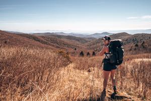
This section of the Appalachian Trail leads to one of the best views of North Carolina’s mountains. My friend Ashley and I (and my pup Ollie!) hiked to Siler Bald and camped on the top of the mountain. It was one of the best backpacking experiences I’ve had weather-wise and the views are phenomenal.
Hiking Up to Siler Bald
We started the trail at around 4:30pm from Wayah Gap, an easy to miss spot off of Wayah Road. There is a small pull-off parking area that will fit about three cars on the side of the road. Look for the sign for the road that goes up to the Wayah Bald Tower. If you’re coming from the east, the sign and turn off will be on the right and the parking area is just before the sign. The trail starts with a series of stairs across the street.


You’ll follow the white blazes that mark the Appalachian Trail up the mountain. After a short quarter-mile climb, the trail levels out for an easier climb. You’ll hike through the forest until you get to Snowbird Gap at 1.5 miles. There is a trail here to the left that leads to a shelter, but you will turn to the right, departing the Appalachian Trail. It is a very steep climb up the Siler Bald Vista Trail to the summit. You leave the forested area and climb the grassy slopes of Siler Bald. The views really open up here.


Camping
There is one campsite that is almost to the top. There was another couple already set up there when we arrived, so we continued on to the peak. We made it to the top after about an hour of climbing. One other couple was at the top with their tent already set up. There was room for one more tent, so we snagged the spot.


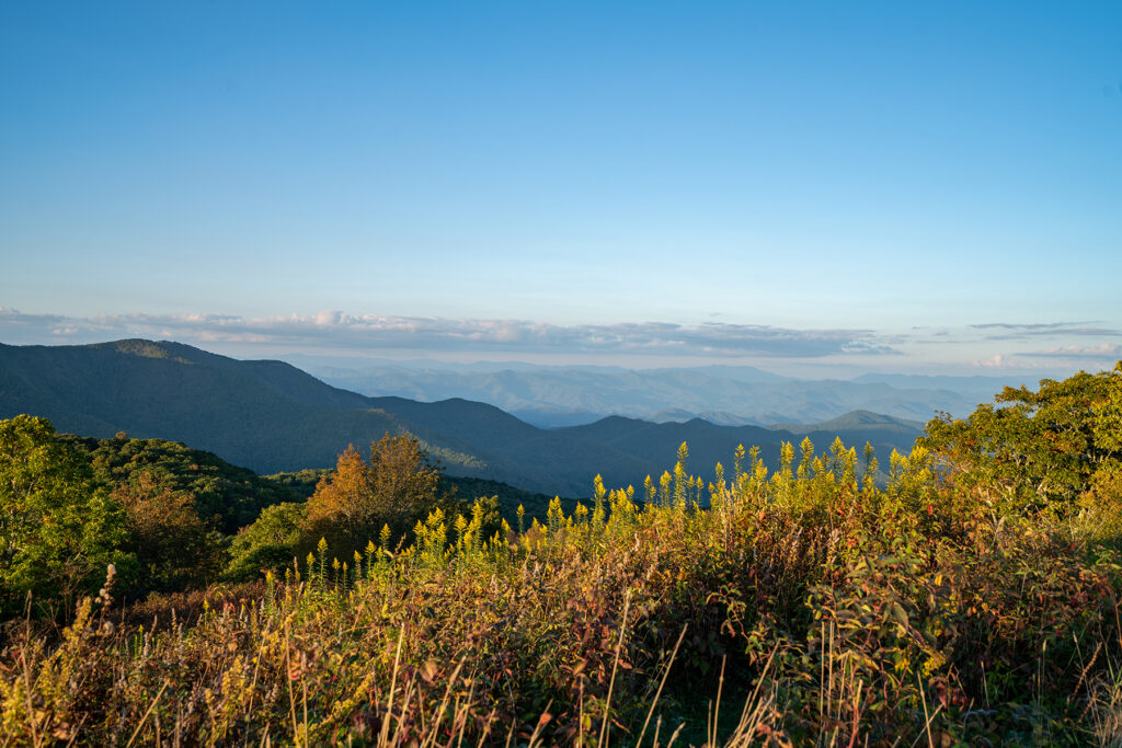
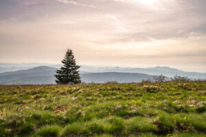
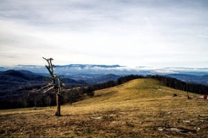
There are 360 degree panoramic views from the Siler Bald summit, which is at 5,216 feet in elevation. You can see countless North Carolina and Georgia mountain peaks. Sunset was around 7:15pm that night so we set up our campsite, made dinner, and took in the views. We were done cleaning up dinner just in time to take some sunset pictures.


There is a campfire ring at the campsite, but we did not need it (and it was right up next to our tent that we did not want to light on fire lol), so we climbed into our tent and hung out and talked until bedtime. The wind was really peaceful all night and we slept well.

Sunrise
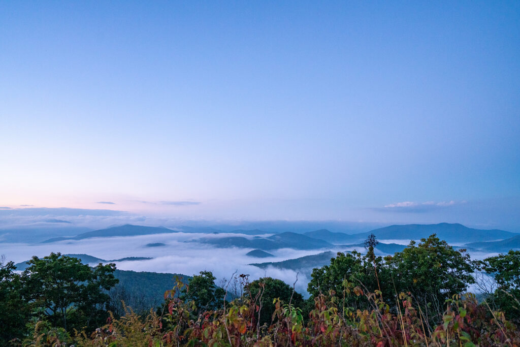
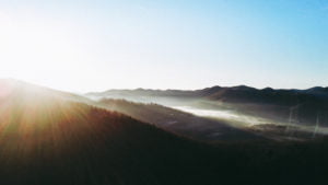
I woke up just before sunrise, and came out of the tent to find a cloud inversion! I have always wanted to witness one. This phenomenon happens when the normal temperature distribution of air (where it is warm at the bottom and colder as you go up) becomes inverted. This means there is a cold layer of air trapped at ground level, overlain by warm air. A layer of clouds blanket the mountains, with island-like mountaintops peeking out of the mist.
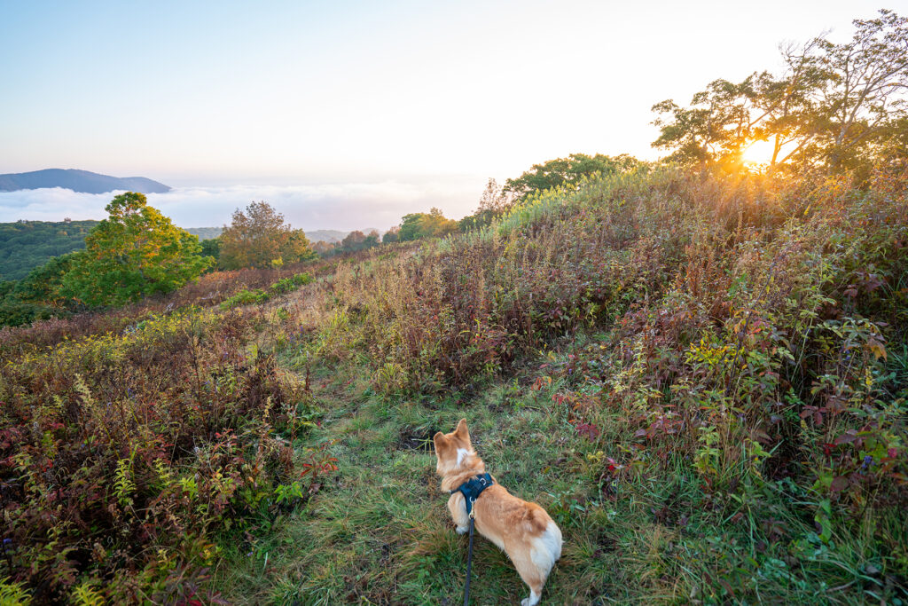


We took tons of photos, made breakfast, and packed up our campsite. The cloud inversion (I’m guessing) had caused the inside of our tent and all our gear to be soaking wet from the humidity. We laid it out in the sun to dry while we were making breakfast, but it didn’t even come close before we hiked back down.
Hiking Down
We made the steep climb back down the mountain and back to our car the same way we hiked up. We arrived back at our car at 10am.
What an awesome hike! It is perfect for a short one-night backpacking trip, a day hike, or you could add it on to a longer multi-day backpacking trip along the Appalachian Trail.
Gear to Bring
Check out my post on my favorite hiking gear to bring for a trip like this. I own and love all of the gear I recommend!

You may also be interested in:

Discover more from Young Wayfarer
Subscribe to get the latest posts sent to your email.

Rob
Beautiful spot. Looks like you had a great time.
Melissa
Thanks, we really did!
Beth
Exhilarating!
I want to see a mountaintop cloud inversion. So pretty.
Your photos and description are wonderful!
Melissa
It was so cool! Thank you! 🙂